 vesseltracker.com
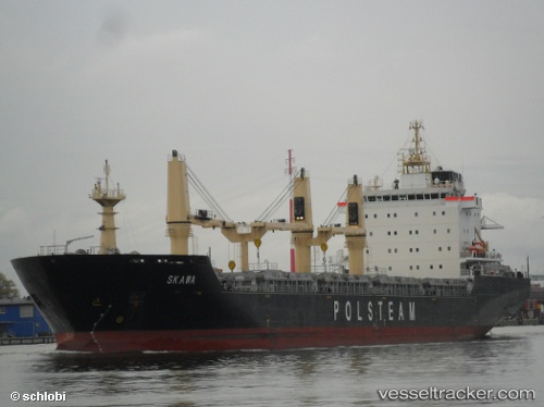
 Skawa
Skawa
Current Status
Where is the vessel?
Skawa is currently in Near Saint George, based on AIS data received about 1h ago.
Latest AIS update:
Current position: 32.37855° N, 64.68083° W (Near Saint George)
Average speed (last 7 days): Loading…
Average speed (last 30 days): Loading…
Vessel profile: Skawa is a Bulk Carrier with dimensions 150m x 150m.
This page combines live AIS, route history, probable destination signals, nearby traffic, and port activity for practical vessel monitoring.
The current position of vessel Skawa is 32.37855 lat / -64.68083 lng. Updated: 2026-05-13 22:44:28 UTCCurrently sailing under the flag of Liberia ![]()
Skawa built in 2012 year
Deadweight:
16600 tDetails:
Live Vessel Skawa Analytics (details, animations, etc.)
Recent AIS points (UTC):
2026-05-13 19:35:31 UTC · 32.37852, -64.68084 · SOG 0 kn · COG 248°2026-05-13 19:50:31 UTC · 32.37853, -64.68085 · SOG 0 kn · COG 248°
2026-05-13 21:50:17 UTC · 32.37853, -64.68083 · SOG 0 kn · COG 247°
2026-05-13 22:44:28 UTC · 32.37855, -64.68083 · SOG 0 kn · COG 247°