 vesseltracker.com
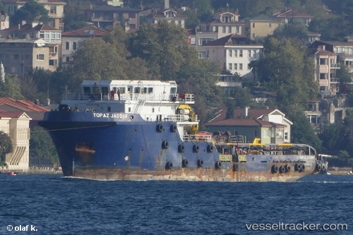
 TOPAZ JADDAF
Current Status
Where is the vessel?
TOPAZ JADDAF is currently in Near AL ADABIYAH, based on AIS data received about 3d ago.
Latest AIS update:
Current position: 29.86167° N, 32.54167° E (Near AL ADABIYAH)
Average speed (last 7 days): Loading…
Average speed (last 30 days): Loading…
Vessel profile: TOPAZ JADDAF is a Anchor Handling Vessel with dimensions m x m.
This page combines live AIS, route history, probable destination signals, nearby traffic, and port activity for practical vessel monitoring.
The current position of vessel TOPAZ JADDAF is 29.86167 lat / 32.54167 lng. Updated: 2026-05-12 16:22:39 UTCNearest reference points:
- Near Bur Ibrahim
- Near SUEZ PORT
- Near AL ADABIYAH
Currently sailing under the flag of Marshall Islands ![]()
Details:
Live Vessel TOPAZ JADDAF Analytics (details, animations, etc.)
Recent AIS points (UTC):
2026-05-12 16:22:39 UTC · 29.86167, 32.54167 · SOG 0 kn · COG -1°2026-05-12 16:22:39 UTC · 29.86167, 32.54167 · SOG 0 kn · COG -1°
2026-05-12 16:22:39 UTC · 29.86167, 32.54167 · SOG 0 kn · COG -1°
2026-05-12 16:22:39 UTC · 29.86167, 32.54167 · SOG 0 kn · COG -1°