 vesseltracker.com
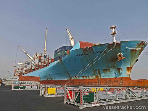
Maersk Calabar
Current StatusWhere is the vessel?
Maersk Calabar is currently in 10 nm S of ZHOUSHAN, based on AIS data received about 23h ago.
Latest AIS update:
Current position: 29.79767° N, 122.16485° E (10 nm S of ZHOUSHAN)
Average speed (last 7 days): Loading…
Average speed (last 30 days): Loading…
Vessel profile: Maersk Calabar is a Container Ship with dimensions 37m x 249m.
This page combines live AIS, route history, probable destination signals, nearby traffic, and port activity for practical vessel monitoring.
The current position of vessel Maersk Calabar is 29.79767 lat / 122.16485 lng. Updated: 2026-05-15 07:36:23 UTCNearest reference points:
- 10 nm SE of Daxie Pt
- Near ZHOUSHAN
- 11 nm S of ZHOUSHAN
Details:
Live Vessel Maersk Calabar Analytics (details, animations, etc.)
Recent AIS points (UTC):
2026-05-15 07:36:23 UTC · 29.79767, 122.16485 · SOG 0 kn · COG 73°2026-05-15 07:36:23 UTC · 29.79767, 122.16485 · SOG 0 kn · COG 73°
2026-05-15 07:36:23 UTC · 29.79767, 122.16485 · SOG 0 kn · COG 73°
2026-05-15 07:36:23 UTC · 29.79767, 122.16485 · SOG 0 kn · COG 73°