 vesseltracker.com
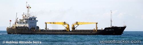
Haibinh16
Current StatusWhere is the vessel?
Haibinh16 is currently in 12 nm E of KUALA TERENGGANU, based on AIS data received about 3h ago.
Latest AIS update:
Current position: 5.33354° N, 103.34356° E (12 nm E of KUALA TERENGGANU)
Average speed (last 7 days): Loading…
Average speed (last 30 days): Loading…
Vessel profile: Haibinh16 is a Bulk Carrier with dimensions 13m x 91m.
This page combines live AIS, route history, probable destination signals, nearby traffic, and port activity for practical vessel monitoring.
The current position of vessel Haibinh16 is 5.33354 lat / 103.34356 lng. Updated: 2026-05-14 23:43:40 UTCNearest reference points:
- 29 nm SW of Dulang Marine Terminal
- Near KEMAMAN
- Near Cukai
Details:
Live Vessel Haibinh16 Analytics (details, animations, etc.)
Recent AIS points (UTC):
2026-05-14 20:15:10 UTC · 5.83570, 103.08689 · SOG 9.8 kn · COG 142°2026-05-14 22:11:12 UTC · 5.56614, 103.25574 · SOG 9.8 kn · COG 159°
2026-05-14 22:30:53 UTC · 5.51612, 103.27492 · SOG 9.7 kn · COG 164°
2026-05-14 23:43:40 UTC · 5.33354, 103.34356 · SOG 9.5 kn · COG 158°