 vesseltracker.com
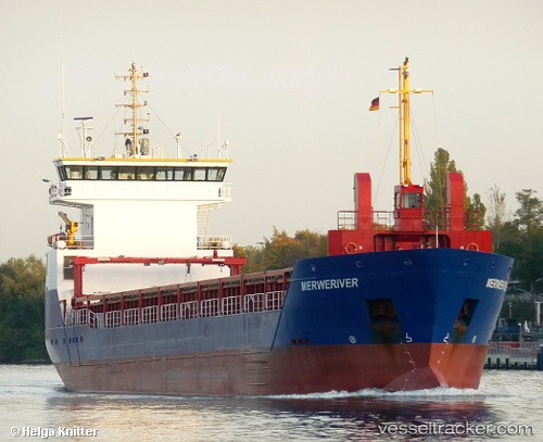
 Eems River
Current Status
Where is the vessel?
Eems River is currently in Near Cuxhaven, based on AIS data received about 1h ago.
Latest AIS update:
Current position: 53.85950° N, 8.72916° E (Near Cuxhaven)
Average speed (last 7 days): Loading…
Average speed (last 30 days): Loading…
Vessel profile: Eems River is a General Cargo Ship with dimensions 90m x 13m.
This page combines live AIS, route history, probable destination signals, nearby traffic, and port activity for practical vessel monitoring.
The current position of vessel Eems River is 53.85950 lat / 8.72916 lng. Updated: 2026-05-13 19:53:11 UTCNearest reference points:
- Near BUESUM
- Near Bremerhaven
- Near Kiel Canal
Currently sailing under the flag of Netherlands ![]()
Eems River built in 2012 year
Deadweight:
4066 tDetails:
Live Vessel Eems River Analytics (details, animations, etc.)
Recent AIS points (UTC):
2026-05-13 16:31:58 UTC · 53.85947, 8.72916 · SOG 0 kn · COG 129°2026-05-13 17:26:10 UTC · 53.85949, 8.72917 · SOG 0 kn · COG 129°
2026-05-13 19:50:11 UTC · 53.85950, 8.72915 · SOG 0 kn · COG 129°
2026-05-13 19:53:11 UTC · 53.85950, 8.72916 · SOG 0 kn · COG 129°