 vesseltracker.com
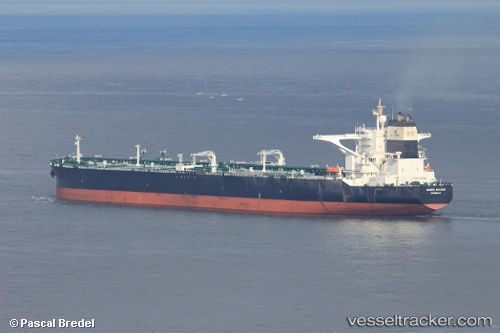
 DHT AMAZON
Current Status
Where is the vessel?
DHT AMAZON is currently in 20 nm NW of MAILIAO, based on AIS data received less than 1h ago.
Latest AIS update:
Current position: 24.08053° N, 120.01180° E (20 nm NW of MAILIAO)
Average speed (last 7 days): Loading…
Average speed (last 30 days): Loading…
Vessel profile: DHT AMAZON is a Crude Oil Tanker with dimensions m x m.
This page combines live AIS, route history, probable destination signals, nearby traffic, and port activity for practical vessel monitoring.
The current position of vessel DHT AMAZON is 24.08053 lat / 120.01180 lng. Updated: 2026-05-15 18:01:04 UTCNearest reference points:
- Near MAILIAO
- Near Tai-tung Kang
- Near TAICHUNG
Currently sailing under the flag of Marshall Islands ![]()
Details:
Live Vessel DHT AMAZON Analytics (details, animations, etc.)
Recent AIS points (UTC):
2026-05-15 14:24:25 UTC · 24.65165, 120.31410 · SOG 10.3 kn · COG 201°2026-05-15 15:42:45 UTC · 24.44346, 120.22514 · SOG 10.4 kn · COG 204°
2026-05-15 16:54:14 UTC · 24.24868, 120.13549 · SOG 10.8 kn · COG 213°
2026-05-15 18:01:04 UTC · 24.08053, 120.01180 · SOG 10.9 kn · COG 219°