 vesseltracker.com
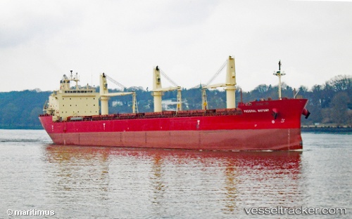
 FEDERAL MAYUMI
Current Status
Where is the vessel?
FEDERAL MAYUMI is currently in Near Newburgh Heights, based on AIS data received less than 1h ago.
Latest AIS update:
Current position: 41.50630° N, 81.70520° W (Near Newburgh Heights)
Average speed (last 7 days): Loading…
Average speed (last 30 days): Loading…
Vessel profile: FEDERAL MAYUMI is a Bulk Carrier with dimensions 200m x 200m.
This page combines live AIS, route history, probable destination signals, nearby traffic, and port activity for practical vessel monitoring.
The current position of vessel FEDERAL MAYUMI is 41.50630 lat / -81.70520 lng. Updated: 2026-05-15 05:44:24 UTCNearest reference points:
- Near Linndale
- Near Scudder
- Near Put-In-Bay
Currently sailing under the flag of Marshall Islands ![]()
FEDERAL MAYUMI built in 2012 year
Deadweight:
35300 tDetails:
Live Vessel FEDERAL MAYUMI Analytics (details, animations, etc.)
Recent AIS points (UTC):
2026-05-14 23:32:24 UTC · 41.50631, -81.70521 · SOG 0.1 kn · COG 146°2026-05-15 03:56:24 UTC · 41.50630, -81.70520 · SOG 0 kn · COG 146°
2026-05-15 04:14:24 UTC · 41.50631, -81.70521 · SOG 0.1 kn · COG 146°
2026-05-15 05:44:24 UTC · 41.50630, -81.70520 · SOG 0.1 kn · COG 146°