 vesseltracker.com
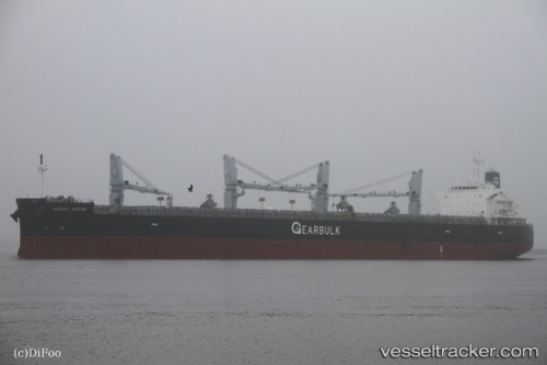
Nandu Arrow
Current StatusWhere is the vessel?
Nandu Arrow is currently in Near Sao Francisco Do Sul, based on AIS data received less than 1h ago.
Latest AIS update:
Current position: 26.23643° S, 48.63907° W (Near Sao Francisco Do Sul)
Average speed (last 7 days): Loading…
Average speed (last 30 days): Loading…
Vessel profile: Nandu Arrow is a Bulk Carrier with dimensions 32m x 200m.
This page combines live AIS, route history, probable destination signals, nearby traffic, and port activity for practical vessel monitoring.
The current position of vessel Nandu Arrow is -26.23643 lat / -48.63907 lng. Updated: 2026-05-14 23:48:34 UTCNearest reference points:
- Near Itajai
- 10 nm NE of CAMBORIU
- 24 nm E of Caioba
Details:
Live Vessel Nandu Arrow Analytics (details, animations, etc.)
Recent AIS points (UTC):
2026-05-14 19:45:34 UTC · -26.23640, -48.63912 · SOG 0 kn · COG 137°2026-05-14 21:36:32 UTC · -26.23646, -48.63915 · SOG 0 kn · COG 137°
2026-05-14 22:27:32 UTC · -26.23655, -48.63903 · SOG 0.2 kn · COG 137°
2026-05-14 23:48:34 UTC · -26.23643, -48.63907 · SOG 0 kn · COG 137°