 vesseltracker.com
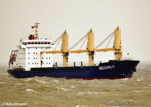
Xing Guang 18
Current StatusWhere is the vessel?
Xing Guang 18 is currently in Near JINGTANG, based on AIS data received less than 1h ago.
Latest AIS update:
Current position: 39.15645° N, 119.12045° E (Near JINGTANG)
Average speed (last 7 days): Loading…
Average speed (last 30 days): Loading…
Vessel profile: Xing Guang 18 is a General Cargo Ship with dimensions 20m x 140m.
This page combines live AIS, route history, probable destination signals, nearby traffic, and port activity for practical vessel monitoring.
The current position of vessel Xing Guang 18 is 39.15645 lat / 119.12045 lng. Updated: 2026-05-14 19:13:48 UTCNearest reference points:
- Near JINGTANG
- 19 nm SE of JINGTANG
- 28 nm SE of JINGTANG
Details:
Live Vessel Xing Guang 18 Analytics (details, animations, etc.)
Recent AIS points (UTC):
2026-05-14 15:37:44 UTC · 39.15537, 119.11821 · SOG 0 kn · COG 88°2026-05-14 17:01:47 UTC · 39.15564, 119.11831 · SOG 0 kn · COG 115°
2026-05-14 18:14:49 UTC · 39.15500, 119.11833 · SOG 0 kn · COG -1°
2026-05-14 19:13:48 UTC · 39.15645, 119.12045 · SOG 0.4 kn · COG 201°