 vesseltracker.com
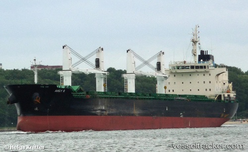
Angy R
Current StatusWhere is the vessel?
Angy R is currently in Near Jorf Lasfar, based on AIS data received about 3h ago.
Latest AIS update:
Current position: 33.12964° N, 8.62683° W (Near Jorf Lasfar)
Average speed (last 7 days): Loading…
Average speed (last 30 days): Loading…
Vessel profile: Angy R is a Bulk Carrier with dimensions 28m x 186m.
This page combines live AIS, route history, probable destination signals, nearby traffic, and port activity for practical vessel monitoring.
The current position of vessel Angy R is 33.12964 lat / -8.62683 lng. Updated: 2026-05-14 18:04:25 UTCNearest reference points:
- Near Jorf Lasfar
- 21 nm NW of El Jadida
- 44 nm NW of El Jadida
Details:
Live Vessel Angy R Analytics (details, animations, etc.)
Recent AIS points (UTC):
2026-05-14 15:04:24 UTC · 33.12961, -8.62683 · SOG 0 kn · COG 123°2026-05-14 18:04:25 UTC · 33.12964, -8.62683 · SOG 0 kn · COG 123°
2026-05-14 18:04:25 UTC · 33.12964, -8.62683 · SOG 0 kn · COG 123°
2026-05-14 18:04:25 UTC · 33.12964, -8.62683 · SOG 0 kn · COG 123°