 vesseltracker.com
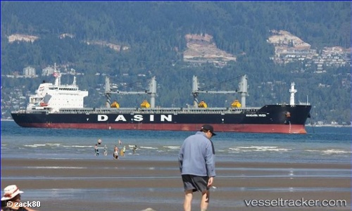
 MANDARIN RIVER
Current Status
Where is the vessel?
MANDARIN RIVER is currently in 18 nm N of Cagdianao, based on AIS data received about 1h ago.
Latest AIS update:
Current position: 10.21677° N, 125.68203° E (18 nm N of Cagdianao)
Average speed (last 7 days): Loading…
Average speed (last 30 days): Loading…
Vessel profile: MANDARIN RIVER is a Bulk Carrier with dimensions m x m.
This page combines live AIS, route history, probable destination signals, nearby traffic, and port activity for practical vessel monitoring.
The current position of vessel MANDARIN RIVER is 10.21677 lat / 125.68203 lng. Updated: 2026-05-15 02:59:52 UTCNearest reference points:
- Near Taganito
- Near Hilongos
- Near Tacloban
Currently sailing under the flag of Singapore ![]()
Details:
Live Vessel MANDARIN RIVER Analytics (details, animations, etc.)
Recent AIS points (UTC):
2026-05-13 07:57:04 UTC · 10.31543, 125.66832 · SOG 0.1 kn · COG 142°2026-05-13 07:57:04 UTC · 10.31543, 125.66832 · SOG 0.1 kn · COG 142°
2026-05-13 07:57:04 UTC · 10.31543, 125.66832 · SOG 0.1 kn · COG 142°
2026-05-15 02:59:52 UTC · 10.21677, 125.68203 · SOG 4.4 kn · COG 208°