 vesseltracker.com
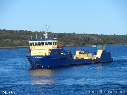
Forseti
Current StatusWhere is the vessel?
Forseti is currently in 31 nm SW of PUERTO NATALES, based on AIS data received about 2h ago.
Latest AIS update:
Current position: 52.08047° S, 73.14623° W (31 nm SW of PUERTO NATALES)
Average speed (last 7 days): Loading…
Average speed (last 30 days): Loading…
Vessel profile: Forseti is a Fish Carrier with dimensions 12m x 59m.
This page combines live AIS, route history, probable destination signals, nearby traffic, and port activity for practical vessel monitoring.
The current position of vessel Forseti is -52.08047 lat / -73.14623 lng. Updated: 2026-05-14 07:59:35 UTCDetails:
Live Vessel Forseti Analytics (details, animations, etc.)
Recent AIS points (UTC):
2026-05-14 04:18:51 UTC · -52.14347, -73.25196 · SOG 9.9 kn · COG 15°2026-05-14 06:23:35 UTC · -52.08007, -73.14586 · SOG 0.2 kn · COG 310°
2026-05-14 07:53:35 UTC · -52.08031, -73.14648 · SOG 0 kn · COG 18°
2026-05-14 07:59:35 UTC · -52.08047, -73.14623 · SOG 0.2 kn · COG 29°