 vesseltracker.com
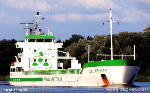
 Penhar
Current Status
Where is the vessel?
Penhar is currently in 169 nm E of Regina, based on AIS data received about 1h ago.
Latest AIS update:
Current position: 4.76295° N, 49.35080° W (169 nm E of Regina)
Average speed (last 7 days): Loading…
Average speed (last 30 days): Loading…
Vessel profile: Penhar is a Multi Purpose Carrier with dimensions 119m x 14m.
This page combines live AIS, route history, probable destination signals, nearby traffic, and port activity for practical vessel monitoring.
The current position of vessel Penhar is 4.76295 lat / -49.35080 lng. Updated: 2026-05-13 23:38:43 UTCCurrently sailing under the flag of Netherlands ![]()
Penhar built in 2010 year
Deadweight:
6500 tDetails:
Live Vessel Penhar Analytics (details, animations, etc.)
Recent AIS points (UTC):
2026-05-13 19:53:52 UTC · 4.28157, -48.81641 · SOG 11.6 kn · COG 312°2026-05-13 21:38:51 UTC · 4.50667, -49.06500 · SOG 11 kn · COG -1°
2026-05-13 22:29:50 UTC · 4.61333, -49.18833 · SOG 11 kn · COG -1°
2026-05-13 23:38:43 UTC · 4.76295, -49.35080 · SOG 11.2 kn · COG 314°