 vesseltracker.com
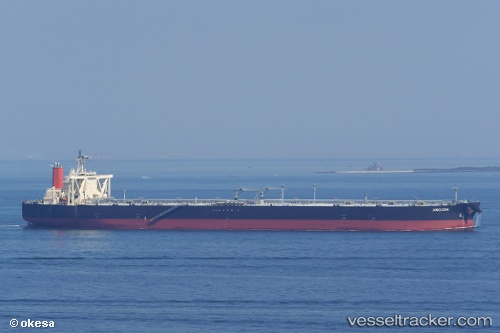
 HAKUSAN
Current Status
Where is the vessel?
HAKUSAN is currently in Near Nipah, based on AIS data received about 2h ago.
Latest AIS update:
Current position: 1.07648° N, 103.60563° E (Near Nipah)
Average speed (last 7 days): Loading…
Average speed (last 30 days): Loading…
Vessel profile: HAKUSAN is a Crude Oil Tanker with dimensions 333m x 60m.
This page combines live AIS, route history, probable destination signals, nearby traffic, and port activity for practical vessel monitoring.
The current position of vessel HAKUSAN is 1.07648 lat / 103.60563 lng. Updated: 2026-05-14 23:45:13 UTCNearest reference points:
- Near BUKOM ISLAND
- Near JURONG ISLAND
- Near Nipah
Currently sailing under the flag of Japan ![]()
HAKUSAN built in 2011 year
Deadweight:
305350 tDetails:
Live Vessel HAKUSAN Analytics (details, animations, etc.)
Recent AIS points (UTC):
2026-05-14 20:15:13 UTC · 1.42773, 103.12815 · SOG 9.7 kn · COG 123°2026-05-14 22:11:54 UTC · 1.20353, 103.38262 · SOG 11.4 kn · COG 130°
2026-05-14 22:31:13 UTC · 1.17044, 103.43063 · SOG 11.2 kn · COG 121°
2026-05-14 23:45:13 UTC · 1.07648, 103.60563 · SOG 9.4 kn · COG 121°