 vesseltracker.com
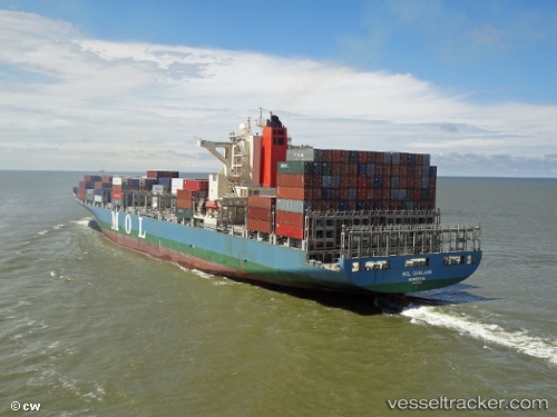
 Mol Garland
Current Status
Where is the vessel?
Mol Garland is currently in 55 nm E of Tantawan Terminal, based on AIS data received less than 1h ago.
Latest AIS update:
Current position: 10.38667° N, 102.28833° E (55 nm E of Tantawan Terminal)
Average speed (last 7 days): Loading…
Average speed (last 30 days): Loading…
Vessel profile: Mol Garland is a Container Ship with dimensions 275m x 275m.
This page combines live AIS, route history, probable destination signals, nearby traffic, and port activity for practical vessel monitoring.
The current position of vessel Mol Garland is 10.38667 lat / 102.28833 lng. Updated: 2026-05-17 16:17:09 UTCNearest reference points:
- 43 nm E of Benchamas
- 63 nm NW of Dai Hung (STS Load)
- Near KRONG PREAH SIHANOUK
Currently sailing under the flag of Portugal ![]()
Mol Garland built in 2011 year
Deadweight:
71409 tDetails:
Live Vessel Mol Garland Analytics (details, animations, etc.)
Recent AIS points (UTC):
2026-05-17 12:59:11 UTC · 10.85333, 101.92667 · SOG 1 kn · COG -1°2026-05-17 14:14:07 UTC · 10.72833, 102.02333 · SOG 12 kn · COG -1°
2026-05-17 15:50:10 UTC · 10.46167, 102.22667 · SOG 12 kn · COG -1°
2026-05-17 16:17:09 UTC · 10.38667, 102.28833 · SOG 12 kn · COG -1°