 vesseltracker.com
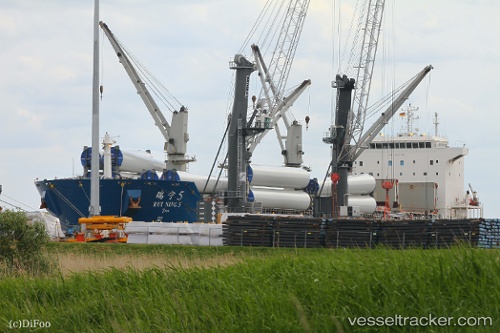
 RUI NING 5
Current Status
Where is the vessel?
RUI NING 5 is currently in 21 nm NE of Lianyungang, based on AIS data received less than 1h ago.
Latest AIS update:
Current position: 34.91337° N, 119.82710° E (21 nm NE of Lianyungang)
Average speed (last 7 days): Loading…
Average speed (last 30 days): Loading…
Vessel profile: RUI NING 5 is a Cargo with dimensions m x m.
This page combines live AIS, route history, probable destination signals, nearby traffic, and port activity for practical vessel monitoring.
The current position of vessel RUI NING 5 is 34.91337 lat / 119.82710 lng. Updated: 2026-05-14 23:41:07 UTCNearest reference points:
- 18 nm E of Lianyungang
- 18 nm N of CHENJIAGANG
- 30 nm NE of CHENJIAGANG
Currently sailing under the flag of China ![]()
Details:
Live Vessel RUI NING 5 Analytics (details, animations, etc.)
Recent AIS points (UTC):
2026-05-14 20:09:27 UTC · 34.91167, 119.82352 · SOG 0.2 kn · COG 66°2026-05-14 22:08:07 UTC · 34.91185, 119.82628 · SOG 0.3 kn · COG 351°
2026-05-14 22:29:07 UTC · 34.91259, 119.82718 · SOG 0.1 kn · COG 320°
2026-05-14 23:41:07 UTC · 34.91337, 119.82710 · SOG 0 kn · COG 219°