 vesseltracker.com
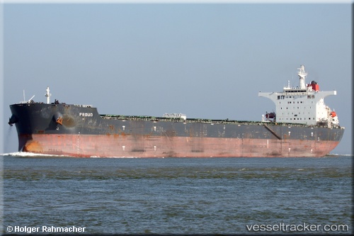
Aquaproud
Current StatusWhere is the vessel?
Aquaproud is currently in 14 nm W of Skardon River, based on AIS data received less than 1h ago.
Latest AIS update:
Current position: 11.74245° S, 141.77284° E (14 nm W of Skardon River)
Average speed (last 7 days): Loading…
Average speed (last 30 days): Loading…
Vessel profile: Aquaproud is a Bulk Carrier with dimensions 45m x 292m.
This page combines live AIS, route history, probable destination signals, nearby traffic, and port activity for practical vessel monitoring.
The current position of vessel Aquaproud is -11.74245 lat / 141.77284 lng. Updated: 2026-05-13 20:01:25 UTCNearest reference points:
- Near Torres Strait
- Near Thursday Island
Details:
Live Vessel Aquaproud Analytics (details, animations, etc.)
Recent AIS points (UTC):
2026-05-13 16:41:27 UTC · -11.74167, 141.77333 · SOG 0 kn · COG -1°2026-05-13 17:43:29 UTC · -11.74270, 141.77264 · SOG 0 kn · COG 127°
2026-05-13 19:29:27 UTC · -11.74167, 141.77167 · SOG 0 kn · COG -1°
2026-05-13 20:01:25 UTC · -11.74245, 141.77284 · SOG 0 kn · COG 137°