 vesseltracker.com
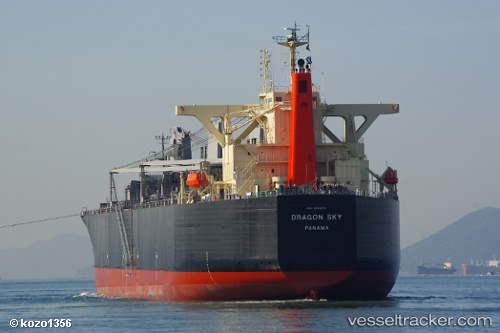
Dragon Sky
Current StatusWhere is the vessel?
Dragon Sky is currently in 35 nm N of FUTONG, based on AIS data received about 3h ago.
Latest AIS update:
Current position: 1.36510° N, 102.17629° E (35 nm N of FUTONG)
Average speed (last 7 days): Loading…
Average speed (last 30 days): Loading…
Vessel profile: Dragon Sky is a Wood Chips Carrier with dimensions 37m x 210m.
This page combines live AIS, route history, probable destination signals, nearby traffic, and port activity for practical vessel monitoring.
The current position of vessel Dragon Sky is 1.36510 lat / 102.17629 lng. Updated: 2026-05-14 18:27:49 UTCNearest reference points:
- 34 nm NW of FUTONG
- 29 nm W of Parit Raja
- Near Pelabuhan Futong Terminal
Details:
Live Vessel Dragon Sky Analytics (details, animations, etc.)
Recent AIS points (UTC):
2026-05-14 16:58:46 UTC · 1.36472, 102.17382 · SOG 0.1 kn · COG 155°2026-05-14 18:00:27 UTC · 1.36549, 102.17550 · SOG 0.2 kn · COG 197°
2026-05-14 18:27:49 UTC · 1.36510, 102.17629 · SOG 0.2 kn · COG 219°
2026-05-14 18:27:49 UTC · 1.36510, 102.17629 · SOG 0.2 kn · COG 219°