 vesseltracker.com
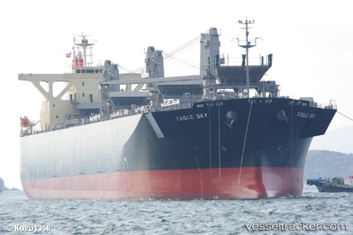
Eagle Sky
Current StatusWhere is the vessel?
Eagle Sky is currently in 314 nm SW of Pampa Melchorita, based on AIS data received about 1h ago.
Latest AIS update:
Current position: 17.07145° S, 81.54260° W (314 nm SW of Pampa Melchorita)
Average speed (last 7 days): Loading…
Average speed (last 30 days): Loading…
Vessel profile: Eagle Sky is a Wood Chips Carrier with dimensions 37m x 210m.
This page combines live AIS, route history, probable destination signals, nearby traffic, and port activity for practical vessel monitoring.
The current position of vessel Eagle Sky is -17.07145 lat / -81.54260 lng. Updated: 2026-05-16 08:04:27 UTCNearest reference points:
- Open sea, approx. 402 nm off the nearest listed port
- Open sea, approx. 411 nm off the nearest listed port
- Open sea, approx. 413 nm off the nearest listed port
Details:
Live Vessel Eagle Sky Analytics (details, animations, etc.)
Recent AIS points (UTC):
2026-05-16 04:11:42 UTC · -16.53240, -81.75625 · SOG 8.7 kn · COG 159°2026-05-16 05:53:48 UTC · -16.77028, -81.66258 · SOG 8.8 kn · COG 156°
2026-05-16 07:40:39 UTC · -17.01571, -81.56457 · SOG 8.8 kn · COG 156°
2026-05-16 08:04:27 UTC · -17.07145, -81.54260 · SOG 8.9 kn · COG 157°