 vesseltracker.com
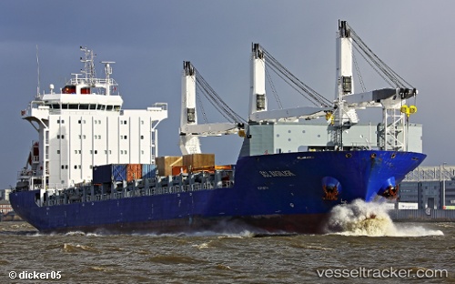
 BBC RHINE
Current Status
Where is the vessel?
BBC RHINE is currently in Near Fenit, based on AIS data received less than 1h ago.
Latest AIS update:
Current position: 52.27069° N, 9.85957° W (Near Fenit)
Average speed (last 7 days): Loading…
Average speed (last 30 days): Loading…
Vessel profile: BBC RHINE is a General Cargo with dimensions m x m.
This page combines live AIS, route history, probable destination signals, nearby traffic, and port activity for practical vessel monitoring.
The current position of vessel BBC RHINE is 52.27069 lat / -9.85957 lng. Updated: 2026-05-15 15:57:20 UTCNearest reference points:
- Near Tarbert Island
- Near CASTLETOWN BEARHAVEN
- Near Skull
Currently sailing under the flag of Antigua and Barbuda ![]()
Details:
Live Vessel BBC RHINE Analytics (details, animations, etc.)
Recent AIS points (UTC):
2026-05-15 11:45:19 UTC · 52.27068, -9.85959 · SOG 0 kn · COG 240°2026-05-15 13:03:20 UTC · 52.27068, -9.85960 · SOG 0 kn · COG 240°
2026-05-15 13:48:19 UTC · 52.27067, -9.85959 · SOG 0 kn · COG 241°
2026-05-15 15:57:20 UTC · 52.27069, -9.85957 · SOG 0 kn · COG 240°