 vesseltracker.com
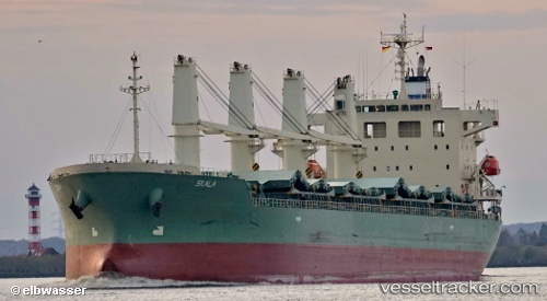
 V LYRA
Current Status
Where is the vessel?
V LYRA is currently in Near Hope Valley, based on AIS data received less than 1h ago.
Latest AIS update:
Current position: 32.21168° S, 115.76301° E (Near Hope Valley)
Average speed (last 7 days): Loading…
Average speed (last 30 days): Loading…
Vessel profile: V LYRA is a Bulk Carrier with dimensions m x m.
This page combines live AIS, route history, probable destination signals, nearby traffic, and port activity for practical vessel monitoring.
The current position of vessel V LYRA is -32.21168 lat / 115.76301 lng. Updated: 2026-05-14 22:27:27 UTCNearest reference points:
- Near Kwinana
- Near Fremantle
- Near ROTTNEST ISLAND
Currently sailing under the flag of Panama ![]()
Details:
Live Vessel V LYRA Analytics (details, animations, etc.)
Recent AIS points (UTC):
2026-05-14 19:15:18 UTC · -32.21163, 115.76297 · SOG 0 kn · COG 303°2026-05-14 20:15:21 UTC · -32.21166, 115.76298 · SOG 0.1 kn · COG 303°
2026-05-14 22:15:19 UTC · -32.21165, 115.76300 · SOG 0 kn · COG 304°
2026-05-14 22:27:27 UTC · -32.21168, 115.76301 · SOG 0 kn · COG 303°