 vesseltracker.com
 YANG A
Current Status
Where is the vessel?
YANG A is currently in Near Venezia, based on AIS data received about 2h ago.
Latest AIS update:
Current position: 45.36411° N, 12.38874° E (Near Venezia)
Average speed (last 7 days): Loading…
Average speed (last 30 days): Loading…
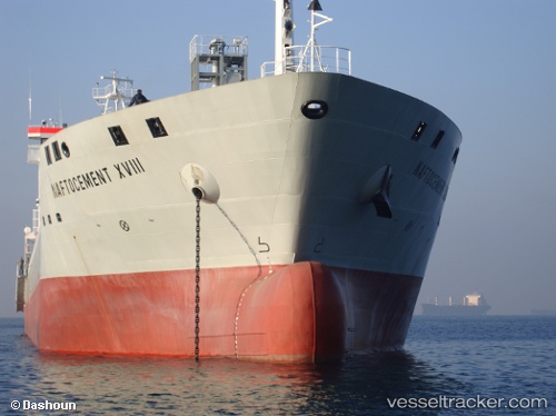
Vessel profile: YANG A is a Cement Carrier with dimensions 156m x 20m.
This page combines live AIS, route history, probable destination signals, nearby traffic, and port activity for practical vessel monitoring.
The current position of vessel YANG A is 45.36411 lat / 12.38874 lng. Updated: 2026-05-14 05:43:02 UTCNearest reference points:
- Near Murano
- Near Venezia
- Near Chioggia
Currently sailing under the flag of Portugal (MAR) ![]()
YANG A built in 2009 year
Deadweight:
15500 tDetails:
Live Vessel YANG A Analytics (details, animations, etc.)
Recent AIS points (UTC):
2026-05-14 01:29:56 UTC · 45.36471, 12.38956 · SOG 0 kn · COG 156°2026-05-14 03:43:04 UTC · 45.36445, 12.38908 · SOG 0 kn · COG 136°
2026-05-14 04:36:12 UTC · 45.36433, 12.38898 · SOG 0 kn · COG 131°
2026-05-14 05:43:02 UTC · 45.36411, 12.38874 · SOG 0 kn · COG 117°