 vesseltracker.com
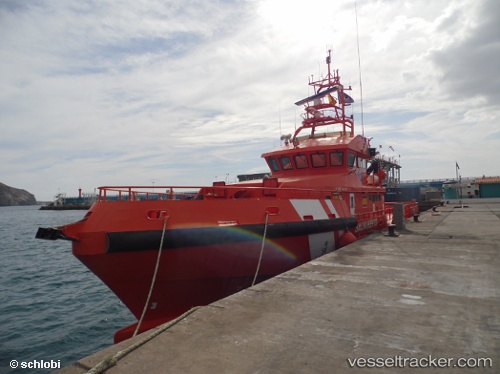
 Guardamar Talia
Current Status
Where is the vessel?
Guardamar Talia is currently in Near Yunquera, based on AIS data received about 128d ago.
Latest AIS update:
Current position: 36.71669° N, 4.41839° W (Near Yunquera)
Average speed (last 7 days): Loading…
Average speed (last 30 days): Loading…
Vessel profile: Guardamar Talia is a Search And Rescue Vessel with dimensions 31m x 8m.
This page combines live AIS, route history, probable destination signals, nearby traffic, and port activity for practical vessel monitoring.
The current position of vessel Guardamar Talia is 36.71669 lat / -4.41839 lng. Updated: 2026-01-05 05:45:29 UTCNearest reference points:
- Near Yunquera
- Near Cala Moral
- Near Arroyo de la Miel
Currently sailing under the flag of Spain ![]()
Guardamar Talia built in 2009 year
Deadweight:
21 tDetails:
Live Vessel Guardamar Talia Analytics (details, animations, etc.)
Recent AIS points (UTC):
2026-01-05 05:45:29 UTC · 36.71669, -4.41839 · SOG 0.1 kn · COG 145°