 vesseltracker.com
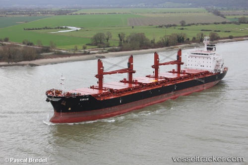
 SIRIUS
Current Status
Where is the vessel?
SIRIUS is currently in 25 nm NW of Palmachim, based on AIS data received less than 1h ago.
Latest AIS update:
Current position: 32.10574° N, 34.25811° E (25 nm NW of Palmachim)
Average speed (last 7 days): Loading…
Average speed (last 30 days): Loading…
Vessel profile: SIRIUS is a Bulk Carrier with dimensions 180m x 30m.
This page combines live AIS, route history, probable destination signals, nearby traffic, and port activity for practical vessel monitoring.
The current position of vessel SIRIUS is 32.10574 lat / 34.25811 lng. Updated: 2026-04-28 07:43:36 UTCNearest reference points:
- 22 nm W of Haifa Granaries
- 17 nm E of Atakka Dry Port
- Near AL ARISH
Currently sailing under the flag of Marshall Islands ![]()
SIRIUS built in 2011 year
Deadweight:
34537 tDetails:
Live Vessel SIRIUS Analytics (details, animations, etc.)
Recent AIS points (UTC):
2026-04-28 04:41:44 UTC · 32.01508, 34.13312 · SOG 11.4 kn · COG 13°2026-04-28 05:55:57 UTC · 32.09940, 34.25696 · SOG 0.6 kn · COG 206°
2026-04-28 07:06:28 UTC · 32.10245, 34.25468 · SOG 0.4 kn · COG 231°
2026-04-28 07:43:36 UTC · 32.10574, 34.25811 · SOG 0.2 kn · COG 170°