 vesseltracker.com
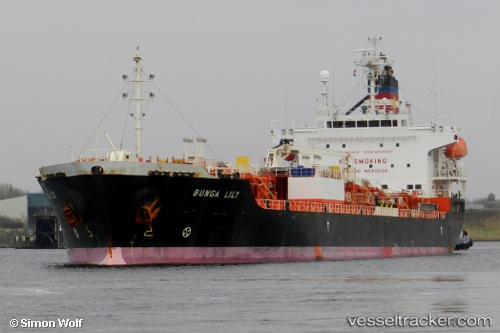
 Bunga Lily
Current Status
Where is the vessel?
Bunga Lily is currently in 13 nm N of Rozi, based on AIS data received less than 1h ago.
Latest AIS update:
Current position: 22.78510° N, 70.08680° E (13 nm N of Rozi)
Average speed (last 7 days): Loading…
Average speed (last 30 days): Loading…
Vessel profile: Bunga Lily is a Chemical Oil Products Tanker with dimensions 147m x 147m.
This page combines live AIS, route history, probable destination signals, nearby traffic, and port activity for practical vessel monitoring.
The current position of vessel Bunga Lily is 22.78510 lat / 70.08680 lng. Updated: 2026-05-14 17:49:37 UTCNearest reference points:
- 15 nm N of Rozi
- 12 nm N of Rozi
- Near Kandla
Currently sailing under the flag of Panama ![]()
Bunga Lily built in 2011 year
Deadweight:
19991 tDetails:
Live Vessel Bunga Lily Analytics (details, animations, etc.)
Recent AIS points (UTC):
2026-05-14 12:19:37 UTC · 22.78412, 70.08410 · SOG 0 kn · COG 33°2026-05-14 15:10:37 UTC · 22.78530, 70.08665 · SOG 0 kn · COG 245°
2026-05-14 16:46:37 UTC · 22.78518, 70.08672 · SOG 0 kn · COG 251°
2026-05-14 17:49:37 UTC · 22.78510, 70.08680 · SOG 0 kn · COG 250°