 vesseltracker.com
 Cape Miron
Current Status
Where is the vessel?
Cape Miron is currently in 24 nm N of BIZERTE, based on AIS data received about 1h ago.
Latest AIS update:
Current position: 37.65360° N, 9.77372° E (24 nm N of BIZERTE)
Average speed (last 7 days): Loading…
Average speed (last 30 days): Loading…
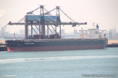
Vessel profile: Cape Miron is a Bulk Carrier with dimensions 289m x 45m.
This page combines live AIS, route history, probable destination signals, nearby traffic, and port activity for practical vessel monitoring.
The current position of vessel Cape Miron is 37.65360 lat / 9.77372 lng. Updated: 2026-05-15 19:51:38 UTCNearest reference points:
- 33 nm SE of Setubal
- 35 nm S of Setubal
- Near Le Kram
Currently sailing under the flag of Liberia ![]()
Cape Miron built in 2009 year
Deadweight:
180274 tDetails:
Live Vessel Cape Miron Analytics (details, animations, etc.)
Recent AIS points (UTC):
2026-05-15 16:32:41 UTC · 37.57888, 10.68693 · SOG 14 kn · COG 279°2026-05-15 17:01:08 UTC · 37.59590, 10.55162 · SOG 13.5 kn · COG 281°
2026-05-15 18:59:29 UTC · 37.64687, 10.01022 · SOG 13 kn · COG 270°
2026-05-15 19:51:38 UTC · 37.65360, 9.77372 · SOG 11.9 kn · COG 270°