 vesseltracker.com
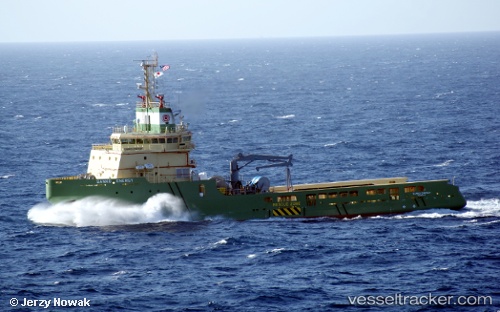
 KAN TAN 222
Current Status
Where is the vessel?
KAN TAN 222 is currently in 42 nm S of Ledong, based on AIS data received less than 1h ago.
Latest AIS update:
Current position: 17.92558° N, 108.71885° E (42 nm S of Ledong)
Average speed (last 7 days): Loading…
Average speed (last 30 days): Loading…
Vessel profile: KAN TAN 222 is a Offshore Tug/Supply Ship with dimensions 18m x 65m.
This page combines live AIS, route history, probable destination signals, nearby traffic, and port activity for practical vessel monitoring.
The current position of vessel KAN TAN 222 is 17.92558 lat / 108.71885 lng. Updated: 2026-05-14 19:17:05 UTCNearest reference points:
- 24 nm SW of San-Ya Chiang
- 14 nm W of San-Ya Chiang
- 12 nm W of San-Ya Chiang
Currently sailing under the flag of China Peopless Republic ![]()
KAN TAN 222 built in 2011 year
Deadweight:
3170 tDetails:
Live Vessel KAN TAN 222 Analytics (details, animations, etc.)
Recent AIS points (UTC):
2026-05-14 15:32:08 UTC · 17.92543, 108.71867 · SOG 0.4 kn · COG 173°2026-05-14 16:56:07 UTC · 17.92558, 108.71900 · SOG 0.2 kn · COG 170°
2026-05-14 18:11:07 UTC · 17.92558, 108.71888 · SOG 0.2 kn · COG 188°
2026-05-14 19:17:05 UTC · 17.92558, 108.71885 · SOG 0.3 kn · COG 185°