 vesseltracker.com
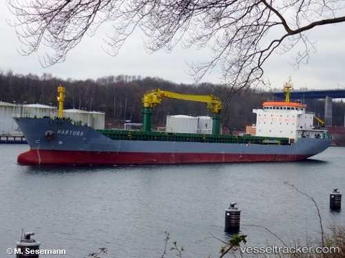
 Mv Hartura
Current Status
Where is the vessel?
Mv Hartura is currently in Near Grado, based on AIS data received less than 1h ago.
Latest AIS update:
Current position: 45.63958° N, 13.30141° E (Near Grado)
Average speed (last 7 days): Loading…
Average speed (last 30 days): Loading…
Vessel profile: Mv Hartura is a General Cargo Ship with dimensions 140m x 20m.
This page combines live AIS, route history, probable destination signals, nearby traffic, and port activity for practical vessel monitoring.
The current position of vessel Mv Hartura is 45.63958 lat / 13.30141 lng. Updated: 2026-05-14 05:46:00 UTCNearest reference points:
- Near Grado
- Near Porto Nogaro
- Near Lignano Sabbiadoro
Currently sailing under the flag of Italy ![]()
Mv Hartura built in 2009 year
Deadweight:
11500 tDetails:
Live Vessel Mv Hartura Analytics (details, animations, etc.)
Recent AIS points (UTC):
2026-05-14 01:27:56 UTC · 45.63884, 13.30124 · SOG 0 kn · COG 84°2026-05-14 03:42:57 UTC · 45.63942, 13.30134 · SOG 0 kn · COG 102°
2026-05-14 04:33:56 UTC · 45.63952, 13.30140 · SOG 0 kn · COG 109°
2026-05-14 05:46:00 UTC · 45.63958, 13.30141 · SOG 0 kn · COG 111°