 vesseltracker.com
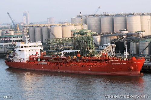
 DONA JOSEFINA
Current Status
Where is the vessel?
DONA JOSEFINA is currently in Near QUINTERO, based on AIS data received less than 1h ago.
Latest AIS update:
Current position: 32.75795° S, 71.50093° W (Near QUINTERO)
Average speed (last 7 days): Loading…
Average speed (last 30 days): Loading…
Vessel profile: DONA JOSEFINA is a Oil/Chemical Tanker with dimensions m x m.
This page combines live AIS, route history, probable destination signals, nearby traffic, and port activity for practical vessel monitoring.
The current position of vessel DONA JOSEFINA is -32.75795 lat / -71.50093 lng. Updated: 2026-05-17 16:09:43 UTCNearest reference points:
- Near Valparaiso
- 28 nm W of Pichilemu
- 100 nm W of Curauma
Details:
Live Vessel DONA JOSEFINA Analytics (details, animations, etc.)
Recent AIS points (UTC):
2026-05-17 13:24:38 UTC · -32.75810, -71.50157 · SOG 0.2 kn · COG 351°2026-05-17 13:33:40 UTC · -32.75803, -71.50121 · SOG 0.3 kn · COG 331°
2026-05-17 15:33:43 UTC · -32.75766, -71.50071 · SOG 0 kn · COG 289°
2026-05-17 16:09:43 UTC · -32.75795, -71.50093 · SOG 0.1 kn · COG 313°