 vesseltracker.com
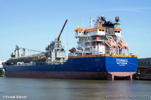
 Stornes
Current Status
Where is the vessel?
Stornes is currently in Near Skipavik - Gulen, based on AIS data received less than 1h ago.
Latest AIS update:
Current position: 60.85686° N, 5.03451° E (Near Skipavik - Gulen)
Average speed (last 7 days): Loading…
Average speed (last 30 days): Loading…
Vessel profile: Stornes is a Pipe Burying Vessel with dimensions 175m x 26m.
This page combines live AIS, route history, probable destination signals, nearby traffic, and port activity for practical vessel monitoring.
The current position of vessel Stornes is 60.85686 lat / 5.03451 lng. Updated: 2026-05-13 21:53:11 UTCNearest reference points:
- Near Eivindvik
- Near Solund
- Near Skålevik
Currently sailing under the flag of Netherlands ![]()
Stornes built in 2011 year
Deadweight:
39353 tDetails:
Live Vessel Stornes Analytics (details, animations, etc.)
Recent AIS points (UTC):
2026-05-13 17:26:10 UTC · 60.85687, 5.03453 · SOG 0 kn · COG 338°2026-05-13 19:50:15 UTC · 60.85688, 5.03450 · SOG 0 kn · COG 337°
2026-05-13 19:56:12 UTC · 60.85688, 5.03453 · SOG 0 kn · COG 337°
2026-05-13 21:53:11 UTC · 60.85686, 5.03451 · SOG 0 kn · COG 338°