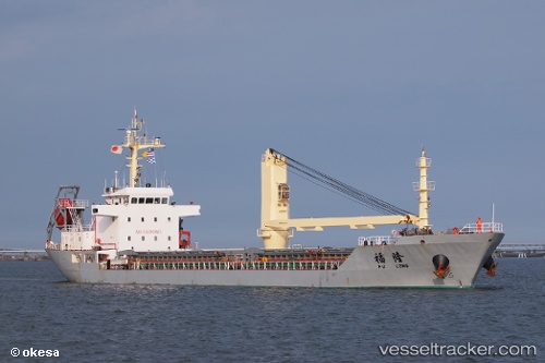
Fu Long
Current StatusWhere is the vessel?
Fu Long is currently in 13 nm NE of CHENJIAGANG, based on AIS data received about 14h ago.
Latest AIS update:
Current position: 34.63025° N, 119.91322° E (13 nm NE of CHENJIAGANG)
Average speed (last 7 days): Loading…
Average speed (last 30 days): Loading…
Vessel profile: Fu Long is a Bulk Carrier with dimensions 16m x 96m.
This page combines live AIS, route history, probable destination signals, nearby traffic, and port activity for practical vessel monitoring.
The current position of vessel Fu Long is 34.63025 lat / 119.91322 lng. Updated: 2026-05-23 21:40:21 UTCNearest reference points:
- 18 nm N of CHENJIAGANG
- 18 nm E of Lianyungang
- 30 nm NE of CHENJIAGANG
Details:
Live Vessel Fu Long Analytics (details, animations, etc.)
Recent AIS points (UTC):
2026-05-23 18:08:26 UTC · 34.62979, 119.91502 · SOG 0.1 kn · COG -1°2026-05-23 19:05:26 UTC · 34.62976, 119.91481 · SOG 0.5 kn · COG -1°
2026-05-23 20:11:25 UTC · 34.63046, 119.91349 · SOG 0.1 kn · COG -1°
2026-05-23 21:40:21 UTC · 34.63025, 119.91322 · SOG 0.1 kn · COG -1°