 vesseltracker.com
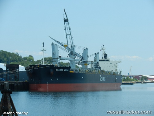
Condor Arrow
Current StatusWhere is the vessel?
Condor Arrow is currently in Near BOTLEK - ROTTERDAM, based on AIS data received about 1h ago.
Latest AIS update:
Current position: 51.89150° N, 4.29720° E (Near BOTLEK - ROTTERDAM)
Average speed (last 7 days): Loading…
Average speed (last 30 days): Loading…
Vessel profile: Condor Arrow is a Bulk Carrier with dimensions 32m x 200m.
This page combines live AIS, route history, probable destination signals, nearby traffic, and port activity for practical vessel monitoring.
The current position of vessel Condor Arrow is 51.89150 lat / 4.29720 lng. Updated: 2026-04-28 06:08:01 UTCNearest reference points:
- Near BOTLEK - ROTTERDAM
- Near Vlaardingen
- Near VLAARDINGEN - ROTTERDAM
Details:
Live Vessel Condor Arrow Analytics (details, animations, etc.)
Recent AIS points (UTC):
2026-04-28 02:22:57 UTC · 51.89172, 4.29745 · SOG 0.1 kn · COG 251°2026-04-28 03:58:57 UTC · 51.89182, 4.29742 · SOG 0.2 kn · COG 251°
2026-04-28 04:49:57 UTC · 51.89175, 4.29728 · SOG 0.1 kn · COG 251°
2026-04-28 06:08:01 UTC · 51.89150, 4.29720 · SOG 0.1 kn · COG 251°