 vesseltracker.com
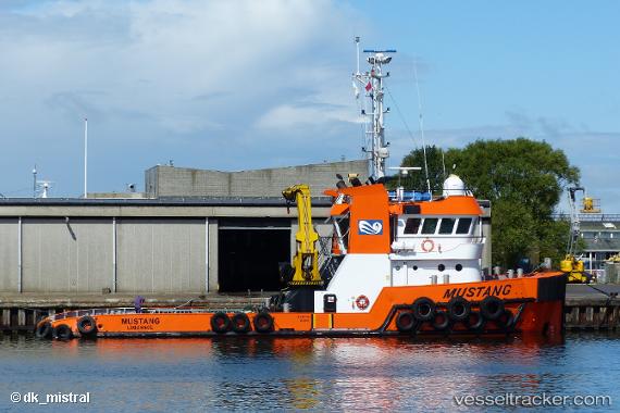
 Mustang
Current Status
Where is the vessel?
Mustang is currently in Near Escravos, based on AIS data received about 1h ago.
Latest AIS update:
Current position: 5.66042° N, 5.07314° E (Near Escravos)
Average speed (last 7 days): Loading…
Average speed (last 30 days): Loading…
Vessel profile: Mustang is a Tug with dimensions 30m x 11m.
This page combines live AIS, route history, probable destination signals, nearby traffic, and port activity for practical vessel monitoring.
The current position of vessel Mustang is 5.66042 lat / 5.07314 lng. Updated: 2026-04-29 01:36:04 UTCNearest reference points:
- Near Escravos
- Near WARRI
- Near Apapa
Currently sailing under the flag of Cyprus ![]()
Mustang built in 2009 year
Deadweight:
217 tDetails:
Live Vessel Mustang Analytics (details, animations, etc.)
Recent AIS points (UTC):
2026-04-28 23:03:59 UTC · 5.66004, 5.07197 · SOG 0.2 kn · COG 203°2026-04-28 23:27:05 UTC · 5.66013, 5.07252 · SOG 0.8 kn · COG 174°
2026-04-29 01:32:12 UTC · 5.66017, 5.07274 · SOG 0.4 kn · COG 167°
2026-04-29 01:36:04 UTC · 5.66042, 5.07314 · SOG 0.4 kn · COG 145°