 vesseltracker.com
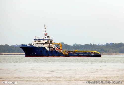
 Harrier
Current Status
Where is the vessel?
Harrier is currently in Near Cilincing, based on AIS data received less than 1h ago.
Latest AIS update:
Current position: 6.09518° S, 106.95708° E (Near Cilincing)
Average speed (last 7 days): Loading…
Average speed (last 30 days): Loading…
Vessel profile: Harrier is a Offshore Tug Supply Ship with dimensions 59m x 14m.
This page combines live AIS, route history, probable destination signals, nearby traffic, and port activity for practical vessel monitoring.
The current position of vessel Harrier is -6.09518 lat / 106.95708 lng. Updated: 2026-05-14 03:48:14 UTCNearest reference points:
- Near Jakarta
- Near New Priok Port
- Near Ancol
Currently sailing under the flag of Indonesia ![]()
Details:
Live Vessel Harrier Analytics (details, animations, etc.)
Recent AIS points (UTC):
2026-05-13 23:45:04 UTC · -6.09513, 106.95704 · SOG 0 kn · COG -1°2026-05-14 01:07:22 UTC · -6.09513, 106.95708 · SOG 0 kn · COG -1°
2026-05-14 01:37:23 UTC · -6.09514, 106.95707 · SOG 0 kn · COG -1°
2026-05-14 03:48:14 UTC · -6.09518, 106.95708 · SOG 0 kn · COG -1°