 vesseltracker.com
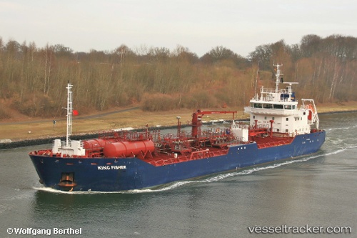
 KING FISHER
Current Status
Where is the vessel?
KING FISHER is currently in 77 nm E of Charlotteville, based on AIS data received about 1h ago.
Latest AIS update:
Current position: 11.65667° N, 59.28833° W (77 nm E of Charlotteville)
Average speed (last 7 days): Loading…
Average speed (last 30 days): Loading…
Vessel profile: KING FISHER is a Oil Products Tanker with dimensions m x m.
This page combines live AIS, route history, probable destination signals, nearby traffic, and port activity for practical vessel monitoring.
The current position of vessel KING FISHER is 11.65667 lat / -59.28833 lng. Updated: 2026-05-14 09:43:49 UTCNearest reference points:
- Near Saint Michael
- 16 nm E of Galeota Point
- Near St. Georges
Currently sailing under the flag of United Kingdom ![]()
Details:
Live Vessel KING FISHER Analytics (details, animations, etc.)
Recent AIS points (UTC):
2026-05-14 06:13:47 UTC · 11.30333, -58.98667 · SOG 7 kn · COG -1°2026-05-14 07:31:47 UTC · 11.43667, -59.09333 · SOG 7 kn · COG -1°
2026-05-14 07:40:48 UTC · 11.45167, -59.10667 · SOG 7 kn · COG -1°
2026-05-14 09:43:49 UTC · 11.65667, -59.28833 · SOG 8 kn · COG -1°