 vesseltracker.com
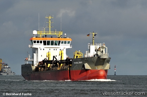
Shoalway
Current StatusWhere is the vessel?
Shoalway is currently in Near Krieschow, based on AIS data received less than 1h ago.
Latest AIS update:
Current position: 51.86969° N, 1.63762° E (Near Krieschow)
Average speed (last 7 days): Loading…
Average speed (last 30 days): Loading…
Vessel profile: Shoalway is a Hopper Dredger with dimensions 20m x 90m.
This page combines live AIS, route history, probable destination signals, nearby traffic, and port activity for practical vessel monitoring.
The current position of vessel Shoalway is 51.86969 lat / 1.63762 lng. Updated: 2026-05-15 07:09:52 UTCNearest reference points:
- 11 nm NW of Krieschow
- Near Dovercourt
- Near Felixstowe
Details:
Live Vessel Shoalway Analytics (details, animations, etc.)
Recent AIS points (UTC):
2026-05-15 03:59:11 UTC · 51.94582, 1.31375 · SOG 1.9 kn · COG 338°2026-05-15 04:41:38 UTC · 51.92472, 1.32085 · SOG 8.6 kn · COG 99°
2026-05-15 06:19:31 UTC · 51.87006, 1.68099 · SOG 8.9 kn · COG 79°
2026-05-15 07:09:52 UTC · 51.86969, 1.63762 · SOG 11.2 kn · COG 286°