 vesseltracker.com
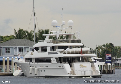
 BLUE TIME
Current Status
Where is the vessel?
BLUE TIME is currently in 29 nm SW of Miller Anchorage, based on AIS data received less than 1h ago.
Latest AIS update:
Current position: 24.26584° N, 76.51015° W (29 nm SW of Miller Anchorage)
Average speed (last 7 days): Loading…
Average speed (last 30 days): Loading…
Vessel profile: BLUE TIME is a Yacht with dimensions m x m.
This page combines live AIS, route history, probable destination signals, nearby traffic, and port activity for practical vessel monitoring.
The current position of vessel BLUE TIME is 24.26584 lat / -76.51015 lng. Updated: 2026-05-14 13:37:03 UTCNearest reference points:
- 30 nm SW of Cape Eleuthera
- 29 nm SW of Cape Eleuthera
- Near Great Exuma Island
Currently sailing under the flag of United States ![]()
Details:
Live Vessel BLUE TIME Analytics (details, animations, etc.)
Recent AIS points (UTC):
2026-05-14 10:23:45 UTC · 24.26500, -76.50833 · SOG 0 kn · COG -1°2026-05-14 10:31:04 UTC · 24.26556, -76.50989 · SOG 0 kn · COG 264°
2026-05-14 11:25:03 UTC · 24.26562, -76.50995 · SOG 0.2 kn · COG 267°
2026-05-14 13:37:03 UTC · 24.26584, -76.51015 · SOG 0.1 kn · COG 198°