 vesseltracker.com
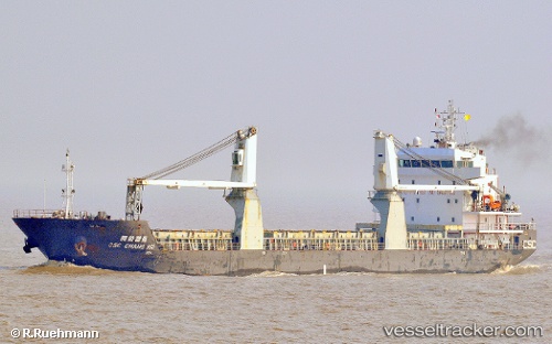
 HAYRIYE ANA
Current Status
Where is the vessel?
HAYRIYE ANA is currently in Near RUMELI FENERI, based on AIS data received about 1h ago.
Latest AIS update:
Current position: 41.28563° N, 29.04053° E (Near RUMELI FENERI)
Average speed (last 7 days): Loading…
Average speed (last 30 days): Loading…
Vessel profile: HAYRIYE ANA is a General Cargo with dimensions m x m.
This page combines live AIS, route history, probable destination signals, nearby traffic, and port activity for practical vessel monitoring.
The current position of vessel HAYRIYE ANA is 41.28563 lat / 29.04053 lng. Updated: 2026-05-14 07:24:21 UTCNearest reference points:
- Near RUMELI FENERI
- Near Istinye/Istambul
- Near Arnavutköy/Istambul
Currently sailing under the flag of Palau ![]()
Details:
Live Vessel HAYRIYE ANA Analytics (details, animations, etc.)
Recent AIS points (UTC):
2026-05-14 05:06:24 UTC · 41.28591, 29.04000 · SOG 0 kn · COG -1°2026-05-14 06:00:54 UTC · 41.28605, 29.04001 · SOG 0 kn · COG -1°
2026-05-14 07:21:20 UTC · 41.28563, 29.04048 · SOG 0 kn · COG -1°
2026-05-14 07:24:21 UTC · 41.28563, 29.04053 · SOG 0 kn · COG -1°