 vesseltracker.com
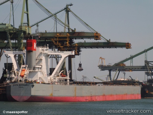
 CAPE NORMANDY
Current Status
Where is the vessel?
CAPE NORMANDY is currently in 202 nm N of Mutineer, based on AIS data received less than 1h ago.
Latest AIS update:
Current position: 16.00858° S, 117.46232° E (202 nm N of Mutineer)
Average speed (last 7 days): Loading…
Average speed (last 30 days): Loading…
Vessel profile: CAPE NORMANDY is a Bulk Carrier with dimensions 292m x 292m.
This page combines live AIS, route history, probable destination signals, nearby traffic, and port activity for practical vessel monitoring.
The current position of vessel CAPE NORMANDY is -16.00858 lat / 117.46232 lng. Updated: 2026-04-28 22:00:33 UTCNearest reference points:
- 244 nm N of Mutineer
- 185 nm NE of Mutineer
- 121 nm NE of Mutineer
Currently sailing under the flag of Japan ![]()
CAPE NORMANDY built in 2012 year
Deadweight:
180646 tDetails:
Live Vessel CAPE NORMANDY Analytics (details, animations, etc.)
Recent AIS points (UTC):
2026-04-28 16:35:26 UTC · -17.02833, 117.71833 · SOG 11 kn · COG -1°2026-04-28 17:50:39 UTC · -16.78667, 117.66167 · SOG 11 kn · COG -1°
2026-04-28 19:44:30 UTC · -16.42333, 117.56667 · SOG 11 kn · COG -1°
2026-04-28 22:00:33 UTC · -16.00858, 117.46232 · SOG 11.4 kn · COG 345°