 vesseltracker.com
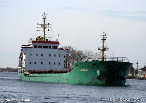
 LAURUS
Current Status
Where is the vessel?
LAURUS is currently in Near Ashdod Bonded, based on AIS data received about 1h ago.
Latest AIS update:
Current position: 31.82101° N, 34.57523° E (Near Ashdod Bonded)
Average speed (last 7 days): Loading…
Average speed (last 30 days): Loading…
Vessel profile: LAURUS is a General Cargo Ship with dimensions 108m x 17m.
This page combines live AIS, route history, probable destination signals, nearby traffic, and port activity for practical vessel monitoring.
The current position of vessel LAURUS is 31.82101 lat / 34.57523 lng. Updated: 2026-04-19 11:23:12 UTCNearest reference points:
- Near AL ARISH
- 22 nm W of Haifa Granaries
- Near Haifa
Currently sailing under the flag of Cameroon ![]()
LAURUS built in 2009 year
Deadweight:
5480 tDetails:
Live Vessel LAURUS Analytics (details, animations, etc.)
Recent AIS points (UTC):
2026-04-19 07:23:11 UTC · 31.82133, 34.57517 · SOG 0.3 kn · COG 257°2026-04-19 09:50:01 UTC · 31.82124, 34.57525 · SOG 0.3 kn · COG 265°
2026-04-19 10:25:41 UTC · 31.82113, 34.57527 · SOG 0.2 kn · COG 266°
2026-04-19 11:23:12 UTC · 31.82101, 34.57523 · SOG 0.3 kn · COG 274°