 vesseltracker.com
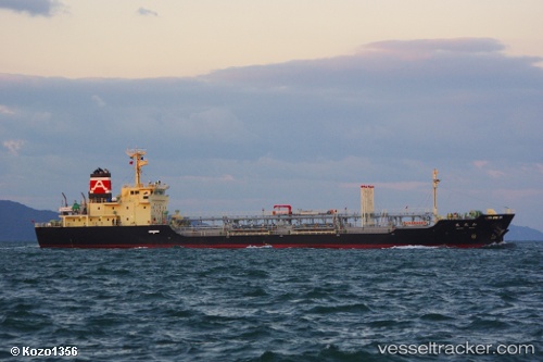
Wakou Maru
Current StatusWhere is the vessel?
Wakou Maru is currently in Near Hakata, based on AIS data received less than 1h ago.
Latest AIS update:
Current position: 33.61866° N, 130.40900° E (Near Hakata)
Average speed (last 7 days): Loading…
Average speed (last 30 days): Loading…
Vessel profile: Wakou Maru is a Oil Products Tanker with dimensions 16m x 104m.
This page combines live AIS, route history, probable destination signals, nearby traffic, and port activity for practical vessel monitoring.
The current position of vessel Wakou Maru is 33.61866 lat / 130.40900 lng. Updated: 2026-05-15 03:35:05 UTCNearest reference points:
- Near Hakata
- Near Hibiki-Nada
- Near KITAKYUSHU
Details:
Live Vessel Wakou Maru Analytics (details, animations, etc.)
Recent AIS points (UTC):
2026-05-14 21:22:28 UTC · 33.63500, 130.27219 · SOG 0.1 kn · COG 343°2026-05-14 22:22:27 UTC · 33.63494, 130.27202 · SOG 0.1 kn · COG 351°
2026-05-15 00:17:38 UTC · 33.61955, 130.40906 · SOG 0.6 kn · COG 246°
2026-05-15 03:35:05 UTC · 33.61866, 130.40900 · SOG 0 kn · COG 286°