 vesseltracker.com
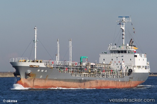
 Kaisei Maru
Current Status
Where is the vessel?
Kaisei Maru is currently in Near Ôshima, Nagasaki, based on AIS data received less than 1h ago.
Latest AIS update:
Current position: 33.20273° N, 129.53487° E (Near Ôshima, Nagasaki)
Average speed (last 7 days): Loading…
Average speed (last 30 days): Loading…
Vessel profile: Kaisei Maru is a Chemical Oil Products Tanker with dimensions 69m x 12m.
This page combines live AIS, route history, probable destination signals, nearby traffic, and port activity for practical vessel monitoring.
The current position of vessel Kaisei Maru is 33.20273 lat / 129.53487 lng. Updated: 2026-05-15 05:48:30 UTCNearest reference points:
- Near TSUKINOKAWA
- Near MATSUSHIMA
- Near Fukushima, Nagasaki
Currently sailing under the flag of Japan ![]()
Details:
Live Vessel Kaisei Maru Analytics (details, animations, etc.)
Recent AIS points (UTC):
2026-05-15 00:17:36 UTC · 33.89758, 130.46298 · SOG 11.1 kn · COG 212°2026-05-15 03:20:49 UTC · 33.61186, 129.84254 · SOG 12.3 kn · COG 226°
2026-05-15 03:20:49 UTC · 33.61186, 129.84254 · SOG 12.3 kn · COG 226°
2026-05-15 05:48:30 UTC · 33.20273, 129.53487 · SOG 12.5 kn · COG 162°