 vesseltracker.com
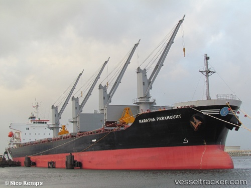
 Maratha Paramount
Current Status
Where is the vessel?
Maratha Paramount is currently in Near Guayaquil, based on AIS data received less than 1h ago.
Latest AIS update:
Current position: 2.24370° S, 79.88031° W (Near Guayaquil)
Average speed (last 7 days): Loading…
Average speed (last 30 days): Loading…
Vessel profile: Maratha Paramount is a Bulk Carrier with dimensions 175m x 29m.
This page combines live AIS, route history, probable destination signals, nearby traffic, and port activity for practical vessel monitoring.
The current position of vessel Maratha Paramount is -2.24370 lat / -79.88031 lng. Updated: 2026-04-28 12:01:40 UTCNearest reference points:
- Near Guayaquil
- Near Samborondon
- Near La Libertad
Currently sailing under the flag of Marshall Is ![]()
Maratha Paramount built in 2011 year
Deadweight:
32081 tDetails:
Live Vessel Maratha Paramount Analytics (details, animations, etc.)
Recent AIS points (UTC):
2026-04-28 07:58:39 UTC · -2.24366, -79.88035 · SOG 0 kn · COG 145°2026-04-28 09:28:39 UTC · -2.24364, -79.88035 · SOG 0 kn · COG 145°
2026-04-28 11:01:40 UTC · -2.24372, -79.88031 · SOG 0 kn · COG 145°
2026-04-28 12:01:40 UTC · -2.24370, -79.88031 · SOG 0 kn · COG 145°