 vesseltracker.com
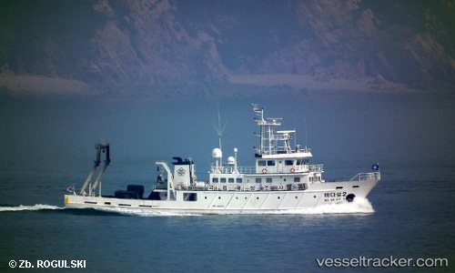
 Badaro2
Current Status
Where is the vessel?
Badaro2 is currently in Near South Busan, based on AIS data received about 4d ago.
Latest AIS update:
Current position: 35.11623° N, 129.15050° E (Near South Busan)
Average speed (last 7 days): Loading…
Average speed (last 30 days): Loading…
Vessel profile: Badaro2 is a Research Vessel with dimensions 46m x 8m.
This page combines live AIS, route history, probable destination signals, nearby traffic, and port activity for practical vessel monitoring.
The current position of vessel Badaro2 is 35.11623 lat / 129.15050 lng. Updated: 2026-04-21 16:55:25 UTCNearest reference points:
- Near Busan
- Near Gamcheon/Busan
- Near Gijang-gun/Busan
Currently sailing under the flag of Korea ![]()
Badaro2 built in 2009 year
Deadweight:
160 tDetails:
Live Vessel Badaro2 Analytics (details, animations, etc.)
Recent AIS points (UTC):
2026-04-21 16:55:25 UTC · 35.11623, 129.15050 · SOG 7.5 kn · COG 185°2026-04-21 16:55:25 UTC · 35.11623, 129.15050 · SOG 7.5 kn · COG 185°
2026-04-21 16:55:25 UTC · 35.11623, 129.15050 · SOG 7.5 kn · COG 185°
2026-04-21 16:55:25 UTC · 35.11623, 129.15050 · SOG 7.5 kn · COG 185°