 vesseltracker.com
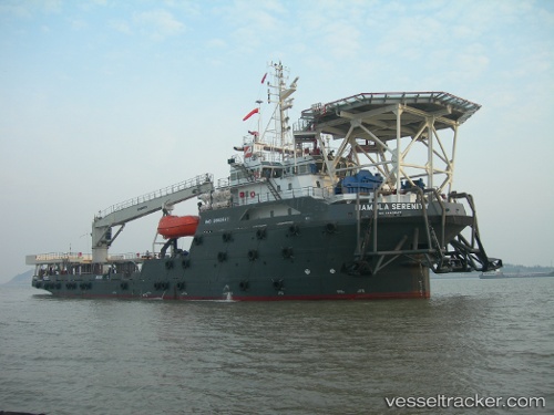
 Mamola Serenity
Current Status
Where is the vessel?
Mamola Serenity is currently in 46 nm N of Anse Kerlan, based on AIS data received about 1h ago.
Latest AIS update:
Current position: 3.53648° S, 55.64600° E (46 nm N of Anse Kerlan)
Average speed (last 7 days): Loading…
Average speed (last 30 days): Loading…
Vessel profile: Mamola Serenity is a Offshore Tug Supply Ship with dimensions 85m x 20m.
This page combines live AIS, route history, probable destination signals, nearby traffic, and port activity for practical vessel monitoring.
The current position of vessel Mamola Serenity is -3.53648 lat / 55.64600 lng. Updated: 2026-05-18 05:53:13 UTCNearest reference points:
- Near Mahé Island Apt
- Near Ile Desroches
Currently sailing under the flag of Marshall Is ![]()
Details:
Live Vessel Mamola Serenity Analytics (details, animations, etc.)
Recent AIS points (UTC):
2026-05-18 01:50:50 UTC · -3.91873, 55.52805 · SOG 6 kn · COG 10°2026-05-18 04:01:55 UTC · -3.68857, 55.56307 · SOG 6.4 kn · COG 11°
2026-05-18 04:53:29 UTC · -3.60523, 55.59737 · SOG 6.4 kn · COG 37°
2026-05-18 05:53:13 UTC · -3.53648, 55.64600 · SOG 4.9 kn · COG 33°