 vesseltracker.com
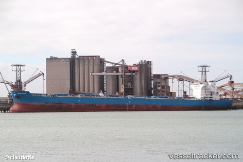
 SEA GLORY
Current Status
Where is the vessel?
SEA GLORY is currently in 77 nm E of Calbayog, Samar, based on AIS data received about 2h ago.
Latest AIS update:
Current position: 12.54598° N, 125.81541° E (77 nm E of Calbayog, Samar)
Average speed (last 7 days): Loading…
Average speed (last 30 days): Loading…
Vessel profile: SEA GLORY is a Bulk Carrier with dimensions m x m.
This page combines live AIS, route history, probable destination signals, nearby traffic, and port activity for practical vessel monitoring.
The current position of vessel SEA GLORY is 12.54598 lat / 125.81541 lng. Updated: 2026-04-25 22:52:24 UTCNearest reference points:
- Near Tacloban
- 40 nm N of Gigmoto, Catanduanes
- Near Hilongos
Currently sailing under the flag of Marshall Islands ![]()
Details:
Live Vessel SEA GLORY Analytics (details, animations, etc.)
Recent AIS points (UTC):
2026-04-25 19:26:37 UTC · 13.17234, 125.77094 · SOG 10.9 kn · COG 177°2026-04-25 19:26:37 UTC · 13.17234, 125.77094 · SOG 10.9 kn · COG 177°
2026-04-25 19:26:37 UTC · 13.17234, 125.77094 · SOG 10.9 kn · COG 177°
2026-04-25 22:52:24 UTC · 12.54598, 125.81541 · SOG 10.7 kn · COG 169°