 vesseltracker.com
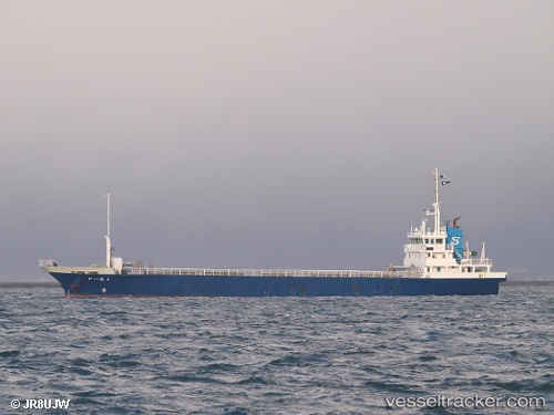
 Kaihou
Current Status
Where is the vessel?
Kaihou is currently in Near Kanmon, based on AIS data received less than 1h ago.
Latest AIS update:
Current position: 33.89313° N, 130.90224° E (Near Kanmon)
Average speed (last 7 days): Loading…
Average speed (last 30 days): Loading…
Vessel profile: Kaihou is a General Cargo Ship with dimensions 74m x 12m.
This page combines live AIS, route history, probable destination signals, nearby traffic, and port activity for practical vessel monitoring.
The current position of vessel Kaihou is 33.89313 lat / 130.90224 lng. Updated: 2026-05-14 17:38:33 UTCNearest reference points:
- Near Kanmon
- Near Kokura
- Near Shimonoseki
Currently sailing under the flag of Japan ![]()
Kaihou built in 2008 year
Deadweight:
1830 tDetails:
Live Vessel Kaihou Analytics (details, animations, etc.)
Recent AIS points (UTC):
2026-05-14 14:02:33 UTC · 33.89313, 130.90224 · SOG 0 kn · COG 13°2026-05-14 15:47:36 UTC · 33.89313, 130.90224 · SOG 0 kn · COG 13°
2026-05-14 16:53:34 UTC · 33.89313, 130.90222 · SOG 0 kn · COG 13°
2026-05-14 17:38:33 UTC · 33.89313, 130.90224 · SOG 0 kn · COG 13°