 vesseltracker.com
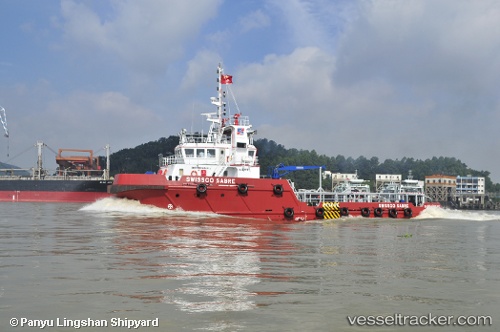
 Gajaja
Current Status
Where is the vessel?
Gajaja is currently in Near Luanda, based on AIS data received less than 1h ago.
Latest AIS update:
Current position: 8.77844° S, 13.27024° E (Near Luanda)
Average speed (last 7 days): Loading…
Average speed (last 30 days): Loading…
Vessel profile: Gajaja is a Offshore Tug Supply Ship with dimensions 40m x 12m.
This page combines live AIS, route history, probable destination signals, nearby traffic, and port activity for practical vessel monitoring.
The current position of vessel Gajaja is -8.77844 lat / 13.27024 lng. Updated: 2026-04-29 04:00:28 UTCNearest reference points:
- Near Luanda
- Near Greater Plutonio
Currently sailing under the flag of St Vincent Grenadines ![]()
Gajaja built in 2010 year
Deadweight:
560 tDetails:
Live Vessel Gajaja Analytics (details, animations, etc.)
Recent AIS points (UTC):
2026-04-28 23:27:30 UTC · -8.77854, 13.27016 · SOG 0 kn · COG 204°2026-04-29 01:30:30 UTC · -8.77849, 13.27029 · SOG 0 kn · COG 187°
2026-04-29 01:33:29 UTC · -8.77850, 13.27025 · SOG 0 kn · COG 213°
2026-04-29 04:00:28 UTC · -8.77844, 13.27024 · SOG 0.1 kn · COG 167°