 vesseltracker.com
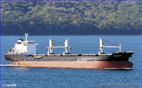
 Sky Height
Current Status
Where is the vessel?
Sky Height is currently in 102 nm NE of Yangkou Pt, based on AIS data received less than 1h ago.
Latest AIS update:
Current position: 33.18458° N, 123.26855° E (102 nm NE of Yangkou Pt)
Average speed (last 7 days): Loading…
Average speed (last 30 days): Loading…
Vessel profile: Sky Height is a Bulk Carrier with dimensions 159m x 24m.
This page combines live AIS, route history, probable destination signals, nearby traffic, and port activity for practical vessel monitoring.
The current position of vessel Sky Height is 33.18458 lat / 123.26855 lng. Updated: 2026-05-15 16:53:24 UTCNearest reference points:
- 99 nm NE of Yangkou Pt
- 79 nm NE of Yangkou Pt
- 91 nm W of Gageohyangri
Currently sailing under the flag of Panama ![]()
Sky Height built in 2010 year
Deadweight:
23113 tDetails:
Live Vessel Sky Height Analytics (details, animations, etc.)
Recent AIS points (UTC):
2026-05-15 13:08:18 UTC · 33.69208, 123.23163 · SOG 8.9 kn · COG 174°2026-05-15 14:08:16 UTC · 33.54667, 123.24167 · SOG 8 kn · COG -1°
2026-05-15 15:47:11 UTC · 33.32667, 123.26667 · SOG 7 kn · COG -1°
2026-05-15 16:53:24 UTC · 33.18458, 123.26855 · SOG 8 kn · COG 184°