 vesseltracker.com
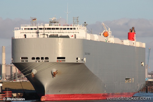
Dalian Highway
Current StatusWhere is the vessel?
Dalian Highway is currently in 59 nm S of Los Cabos, based on AIS data received about 1h ago.
Latest AIS update:
Current position: 21.88122° N, 109.96301° W (59 nm S of Los Cabos)
Average speed (last 7 days): Loading…
Average speed (last 30 days): Loading…
Vessel profile: Dalian Highway is a Vehicles Carrier with dimensions 32m x 199m.
This page combines live AIS, route history, probable destination signals, nearby traffic, and port activity for practical vessel monitoring.
The current position of vessel Dalian Highway is 21.88122 lat / -109.96301 lng. Updated: 2026-05-16 04:54:01 UTCNearest reference points:
- 67 nm S of Los Cabos
- Near Los Cabos
- Near San Jose del Cabo
Details:
Live Vessel Dalian Highway Analytics (details, animations, etc.)
Recent AIS points (UTC):
2026-05-16 01:32:19 UTC · 22.19524, -110.85430 · SOG 15.9 kn · COG 108°2026-05-16 01:35:13 UTC · 22.19076, -110.84137 · SOG 15.8 kn · COG 108°
2026-05-16 04:09:37 UTC · 21.95323, -110.15703 · SOG 15.9 kn · COG 111°
2026-05-16 04:54:01 UTC · 21.88122, -109.96301 · SOG 15.9 kn · COG 109°